Map of M1 Junctions 24A to 30: Nottingham, Derby and Chesterfield
North of the A50 the M1 serves two cities at once. Junction 25 is the turn for both Nottingham and Derby, then the road passes Kimberley, Hucknall and Kirkby-in-Ashfield, runs between Mansfield and Alfreton, and reaches Chesterfield and Hardwick Hall at junction 29.
Commuters into Nottingham, families visiting the Peak District side of Derbyshire, and drivers for the business parks around South Normanton and Markham Vale all depend on this section. The map shows the towns of the old Nottinghamshire and Derbyshire coalfield in their real places.
The road on the map is coloured by the live traffic flow speed, the same data as our live M1 traffic flow map. Choose northbound or southbound above the map. Tap any junction number to open that junction’s own page.
Map data © OpenStreetMap contributors. Map drawing © Corporate Ace Limited.
Driving Junction 24A to Junction 30: Distances and Times
From junction 24A to junction 30 is about 32½ miles along the M1, about 28 minutes at the 70 mph speed limit in clear traffic. Here it is junction by junction; tap a junction to open its own page.
- J24A to J25: about 4 miles, about 4 minutes
- J25 to J26: about 6 miles, about 5 minutes
- J26 to J27: about 5½ miles, about 5 minutes
- J27 to J28: about 3½ miles, about 3 minutes
- J28 to J29: about 7 miles, about 6 minutes
- J29 to J29A: about 3½ miles, about 3 minutes
- J29A to J30: about 3 miles, about 3 minutes
Distances are measured along the motorway between the centres of the junctions, from OpenStreetMap, and rounded to the nearest half mile. Times are at a steady 70 mph and do not allow for joining, leaving, roadworks or lower speed limits, so check the live map above and the live M1 speed flow map before you set off.
M1 Junctions 24A to 30 Now: Accidents, Incidents and Roadworks
Live traffic news at M1 Junctions 24A to 30
Incidents and roadworks between Junction 24 and Junction 30 that we are aware of.
Jct 28 exit slip road lane closure southbound
21:50 (9:50pm)21 Oct 2026reported 11 min ago
- Location
- M1 J28 southbound exit
- Direction
- Southbound
- Lanes closed
- Slip road closed
- Reason
- Maintenance work
- Schedule
- 20:09 (8:09pm) Wed 21 Oct 2026 → 05:00 (5am) Thu 22 Oct 2026
M1 southbound Jct 26 entry slip road lane closure
21:50 (9:50pm)21 Oct 2026reported 11 min ago
- Location
- M1 J26 southbound access
- Direction
- Southbound
- Lanes closed
- Slip road closed
- Reason
- Maintenance work
- Schedule
- 20:26 (8:26pm) Wed 21 Oct 2026 → 06:00 (6am) Thu 22 Oct 2026
M1 Jct 25 exit slip road lane closure southbound
21:50 (9:50pm)21 Oct 2026reported 11 min ago
- Location
- M1 southbound between J26 and J25
- Direction
- Southbound
- Lanes closed
- Slip road closed
- Reason
- Maintenance work
- Schedule
- 20:00 (8pm) Wed 21 Oct 2026 → 06:00 (6am) Thu 22 Oct 2026
Forecast - not confirmed
+ 1 more near Junctions 24A to 30 - see all the M1 traffic news →
This is the news for Junctions 24A to 30 only, not the whole M1. For the rest of the motorway see all the latest M1 traffic news, the overhead signs and the speed limits in force now.
Updated 22:02 (10:02pm) Wed 21 Oct 2026
The Junctions in Section 5
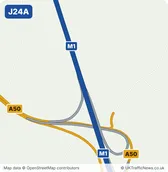
- J24AM1 Junction 24ANearest town: Castle Donington, 2.1 miles south-west
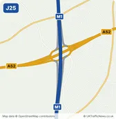
- J25Sandiacre InterchangeNearest town: Sandiacre, 0.7 miles north-east
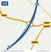
- J26Nuthall InterchangeNearest town: Kimberley, 1.1 miles north-west
- J27M1 Junction 27Nearest town: Kirkby-in-Ashfield, 2.7 miles north
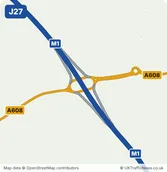
- J28Pinxton InterchangeNearest town: Alfreton, 2.9 miles west
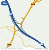
- J29HeathNearest town: Bolsover, 2.5 miles north-east
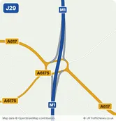
- J29AM1 Junction 29ANearest town: Staveley, 1.8 miles north-west
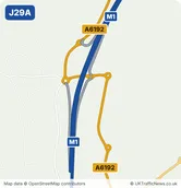
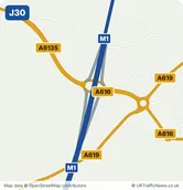
- J30Barlborough InterchangeNearest town: Clowne, 1.6 miles south-east